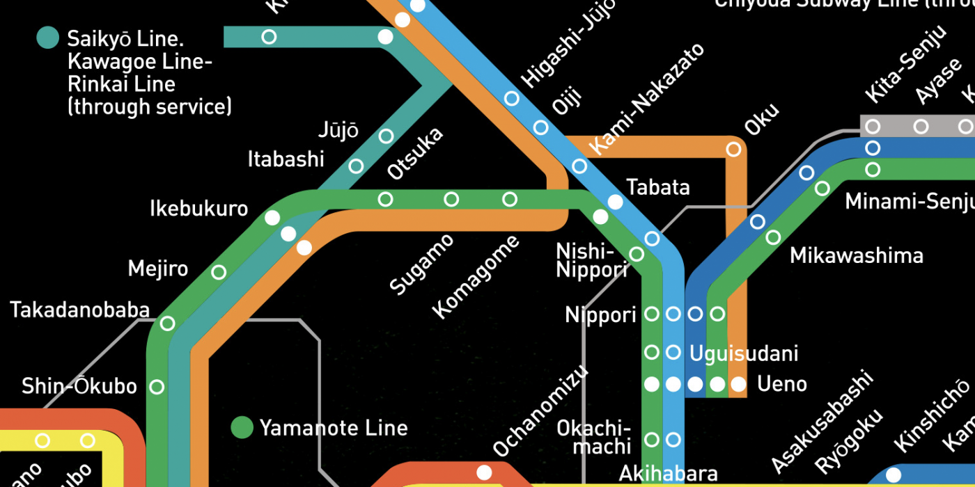
A map illustrating part of the railway system of Tokyo.
- Tools: Illustrator

JR East Tokyo Rail Map
Overview
Tokyo is among the world’s busiest cities, with millions using its extensive network of overground and underground train lines daily. This inspired me to create an illustration showcasing a map of some of the train lines and stations.
Ideation
After reviewing multiple maps of Tokyo’s train lines and stations, I decided to illustrate only the Japan East lines and stations. Despite the overwhelming number of train lines, but having travelled to Japan, I was familiar with them and their associated colours.
I then sketched out ideas for the illustration and created colour swatches to match those used by JR East.
Outcome
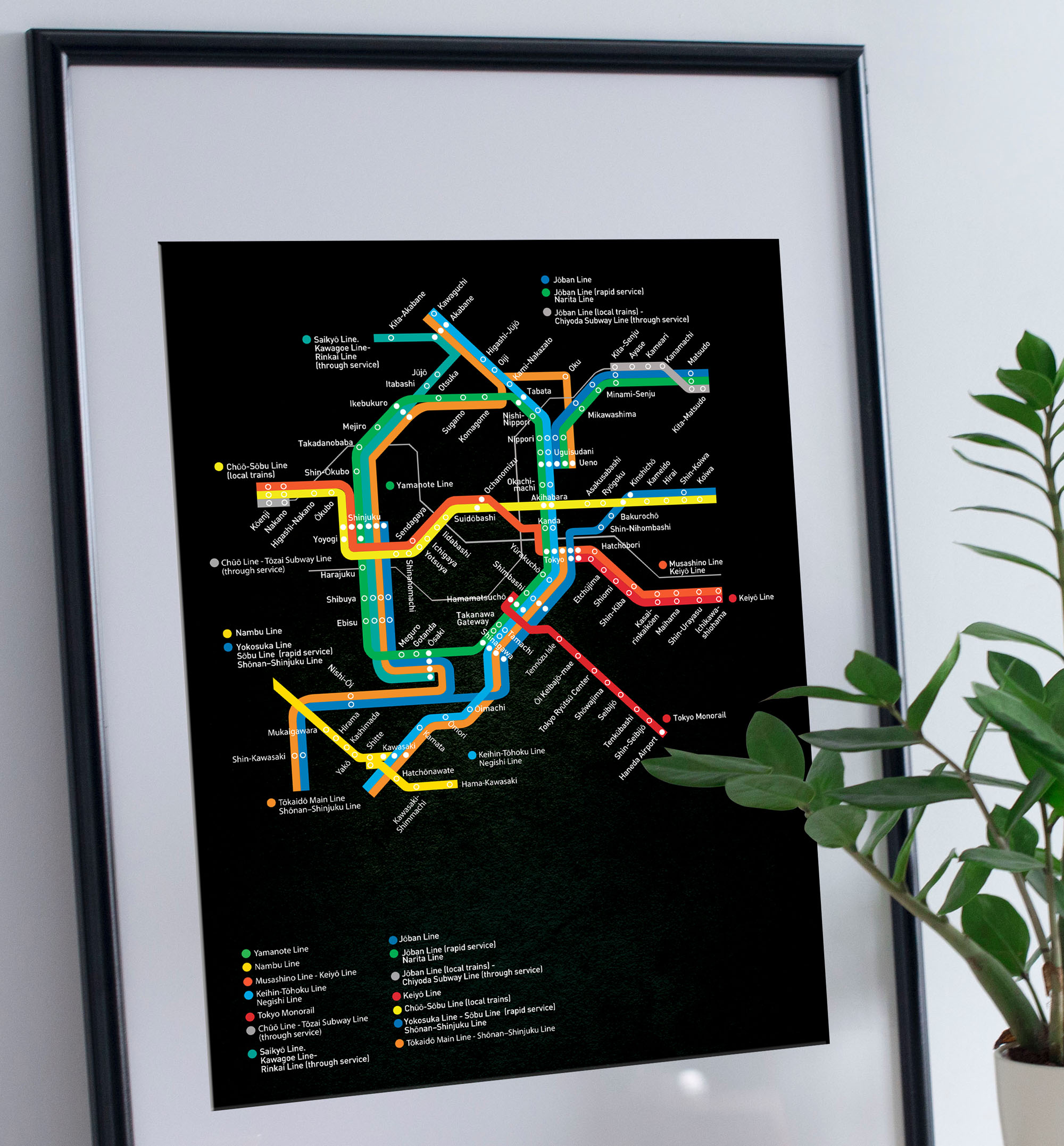
The final illustration utilised colour variations closely matching those used by JR East for their train lines.
I included a key to label these colours, making it easier for viewers to follow the train lines in the illustration.
I placed the illustration and other elements against a black background to enhance contrast and visual impact.